History of Higgins
Cemetery
The
burying ground known as Higgins Cemetery holds at least 11 known graves
of Higgins family members and likely several of their slaves.
James Higgins (1732-1816), a planter who served in the Maryland militia
during the Revolutionary War, and his wife Luraner Becraft Higgins
(1744-1819) were the first generation to be buried on their farm. With
their son James Becraft Higgins (1772-1848) and his wife Mary Eleanor
(1784-1845), they are memorialized by a red sandstone monument that was
placed in the center of the cemetery in 1866 by their descendants.
A grass roots community effort begun
by concerned citizens and Peerless Rockville ignited a series of
actions that led to long-term partnerships. These groups helped
to incorporate Higgins Cemetery Historic Preservation Association in
1999 and obtain designation on the Montgomery County Master Plan for
Historic Preservation in 2010.
Higgins Cemetery, located near the
intersection of the Rockville Pike and Twinbrook Parkway, survives
today as a reminder of how day to day life in America has changed. When
James Higgins settled on his farm in the 18th century, there were few
towns nearby and Washington D.C. did not exist. Travel would have been
a slow process by horseback, carriage, or, on foot. Some
burials were marked with only a rock
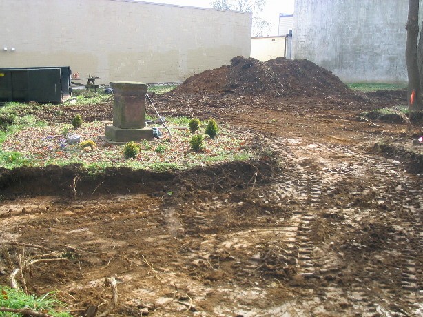
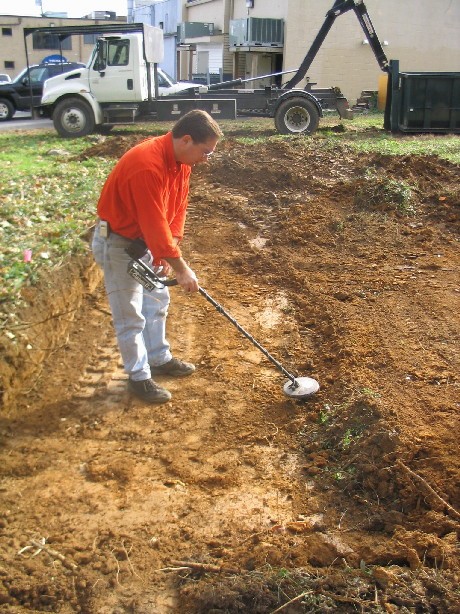
which has rendered their exact locations ephemeral. In 2004
Archeologist, Lyle Torp, conducted a scraping operation to determine
burial locations. The results of this operation, along with the 1927
survey, below, provided the locations for the headstone restoration by
Mosko Cemetery Conservation in 2015.
Archeologist, Lyle Torp and Capital Cities Contractors removed 12 inches of soil to reveal burial locations.
The family burial ground remained part of the
Higgins farm until late in the 19th century. A plat dated 1891 entitled
Spring Lake Park shows the plantation subdivided into small
residential lots with the cemetery and the house site remaining on
larger separate lots. This plat also showed a park and a
railroad station as part of the planned subdivision although neither
was ever built.
An aerial photograph of the site from the late
1930s indicated the roads of this plat had been installed and a number of
the lots showed residential improvements.
The Higgins Farmhouse and most of the frame bungalows were demolished
in the 1950s, 60s, and 70s. Today, the cemetery lot appears much as it did
on the July 15, 1927 survey plat below.
Charles Maddox's, 1927 Survey was used to determine headstore re-plaements in 2015.


